:: W4B photography's companion blog ::
"I have been, and always shall be, your friend. Live long, and prosper... " - Spock
"Pain is temporary. Quitting lasts forever." - Lance Armstrong
:: Tuesday, June 05, 2007 ::
Vacation 5: Up to Crows Nest Pass
So I left Lethbridge mid morning on Friday 1st June heading towards Kelowna in BC. I took the south route via Crows Nest Pass and highway 3. The countryside got fairly rolling as I hit the foothills and then the mountains just got bigger n bigger. One thing that surprised me was the number of wind farms here. One stretch before heading up the grade to CrowsNest had about 50 windmills it seemed. Quite impressive. I got a pamphlet somewhere but I have long since filed it.
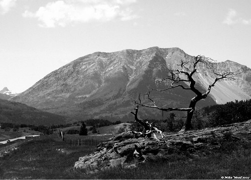
Heading into Crows Nest Pass there stands a tree that has been in the same spot for about 700 years. The Burmis Tree is a limber pine and has an incredibly long lifespan. The roocks dig into rocks and the brances are flexible enough that the strong winds don't snap them, only bend. This tree died in the 1970s and finally toppled to the ground in 1998. Money was raised by governments and local grounds to put the tree back up and to stabilize it with anchoring rods drilled into the sandstone. One of the supports is visible on the left branch.
Can you imagine anything greeting travellers for that long? It was impressive for sure.
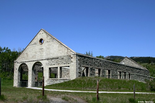
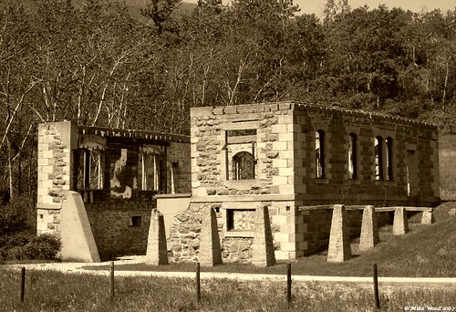
At the top of Crows Nest, I came across an abandoned coal processing facility from the early 20th century. The Leitch Colliery is a big facility that has been well preserved by the local BC tourism folks. I almost passed it by, but turned around and found I was the only one there beside the tour guides. Lindsay - one of the guides, gave me a personal tour of the facility. Normally the tour takes about 15-20 mins, but we chatted for well over 30 mins and I learned a lot about coal mining at the turn of the 20th century. I really had no idea about it. And the fact the coal mined here would be shipped to Europe. The buildings that are remaining. are solid structures made of stone that reminded me of a fortress vibe. The roofs are long since gone, but they are well preserved with lots of displays and information and old photographs on what the place looked like when in operation. Was a good stop over on a hot day. It was getting quite warm. At least 30C today. the guide told me about the landslide that occurred in 1903 too.
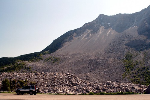
The Frank Slide as it was known occurred further up the pass. It was a massive landslide one night that took down the side of a mountain and buried the mining town of Frank, the coal mine there, and killing more than 70. In a couple of moments, 74 million tons of limestone crashed down and covered over 3 square km of the valley floor. destroyed the railway, created a small lake. Driving through it, it looks like an open pit mine. The rail was put through again in about a month, but the destruction remains. this link is what the slide looks like from space: started lower left and went upper right. http://maps.google.com/?ie=UTF8&ll=49.586511,-114.384241&spn=0.04752,0.135269&t=h&z=14&om=1 the grey area in the centre. all of that is the limestone debris coming from Turtle Mountain . I think the first natural disaster I have visited that is visible from space. Staggering. I took a small piece of limestone from well off the road as a souvenier. :)
Turtle Mountain - or what's left of it, behind the CRV is 7217 feet tall.
And speaking of tall, I think I stopped at the world's highest Timmies just down the pass. Crows Nest is 1396m ASL.
Carpe Diem
:: Mike Wood 13:34 [+] :: 0 comments
...
0 Comments:
FastCounter by bCentral


